The office
Ronaldsway Met Office
An official weather office on an island airfield, with a Manx name, a direct telephone line, and more than seventy-five years of hourly readings.
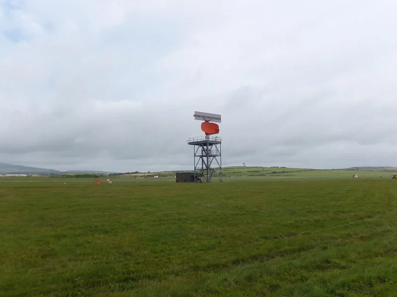
The about-us page on weather.gov.im opens in a way few meteorological offices would dare: not with a mission statement, but with a barn. “Ronaldsway Met Office has a long history dating back to when the field was HMS Urley. The first observations were taken from a barn to the SE of the airfield, near to where the fire station is now, on May 7th 1946, with a proper home on the 1st floor of the control tower established a few weeks later.” [source]
“Observations have been made every hour of every day since, 24/7, including Christmas.” The meteorologists in those days were under the UK Air Ministry, “and they needed to be hardy types.” Electrical thermometers and cloud-base recorders were “not to come into use until 1972,” so observers went out to the instrument enclosure on the airfield every hour — more often when the airport was open — “to take readings, day & night, in whatever conditions.” The page adds, with a grin it has earned: “Of course, the worse the conditions, the more important it was to go out and measure them!” [source]
A heater, a coat, and one souwester
Indoors was not much better. “There was no heating in the control tower building.” In 1959, “Air Ministry management gave in to pressure and provided staff with a paraffin heater for the office, and a duffle coat – just one for all staff to share.” Two years later “they found funds for one oilskin, one pair of boots (big enough for anybody’s feet), and one souwester!” The official history is allowed to be funny, and it is funnier because it is exact. [source]
Celsius replaced Fahrenheit in 1961. In June 1964, “forecasts were issued to Manx Radio for the first time.” The about-us page calls this “the start of The Met Office taking on more of an ‘Isle of Man Weather Centre’ role, in addition to its aviation duties.” In 1965 “the Isle Of Man Airports Board took over from the Air Ministry, and the staff became IOM Civil Servants, and soon started providing warnings to the highway board and other agencies.” [source]
Lock the door behind you
A smaller official sentence, from 1973, is easy to walk past and then impossible to forget. “Airport Security began in 1973 with night-duty observers being asked to lock the door behind them when they went out for the observations.” The weather still had to be read. The door, now, had to be locked first. [source]
Satellite, radar and computer technology “revolutionised forecasting in the 1980’s and 90’s, with a huge leap in the confidence of predictions, and the internet increased the speed with which observations could be sent out, and forecast data sent back.” In 2007, “Ronaldsway forecaster Brian Rae was awarded an MBE for his services to the community and meteorology.” [source]
Viscount House, and a telephone
“These days, Ronaldsway is located in Viscount House, and still has a long standing relationship with the UK Met Office, with access to their model data to be interpreted locally by our own duty forecasters.” Met services are “now more accessible than ever, with 10s of thousands of hits to the weather page at www.weather.gov.im, and unlike the UK, any member of the public can call and speak to a forecaster direct.” [source]
Forecasts and weather data go to “many customers outside of aviation, in areas such as shipping, agriculture and construction.” By providing “advance warnings of severe weather and tidal flooding to agencies such as the DoI and emergency services, they can have staff and resources on hand, ready to deal with issues as they happen, which reduces disruption for us all and gets the Island moving again as quickly as possible.” [source]
The same page ends on the climate record itself: “With over 75 years of continuous high quality measurements, the Ronaldsway dataset is an invaluable resource to monitor our changing climate.” The story of how those measurements began — a barn, a naval airfield, a walk out to the instruments — is on the first observations. [source]
Keep exploring
- The first observations — a barn on HMS Urley, and a walk that has not skipped Christmas.
- The 2025 year — warmth, a rare red warning, and sunshine burned onto cards.
- Useless’s field notes — a few notes from the margin of the official pages.
Enjoyed this island weather desk?
No pop-ups. No intrusive advertising. Just interesting stuff. A little support helps the next storms site get built.